Expansion
Multiple archaeological excavations undertaken during many years around the Mediterranean Sea and on numerous locations, announced the presence of Phoenician and Punic vestiges in the majority of coastal cities. But should the reconstitution of Phoenician expansion history be based exclusively on archaeological information?
For a long time, historians have questioned the nature of the Phoenician facilities, scattered hither and thither, all around the Mediterranean shores. They tried to understand the motivations which have led this people to brave the dangers and embark on water towards the discovery of new horizons. In order to answer these questions, it was necessary to base their judgments on both references at disposal, namely: the written sources (ancient texts), and the archaeological documentation.

Homer's Odyssey - British Museum
The ancient texts represent, like any archive, a basic reference, on account of its relation to contemporary events, but they must be analyzed in their historical context. Within the Egyptian and Mesopotamian archives, specialists have found several texts evoking the Phoenician sailors, among others: the Papyrus of Wenamun, the expedition of Pharaoh Necho, the ballad at sea hosted by the ship-owners of Arwad for the Assyrian emperor Tighlatphalasar... The Old Testament bequeathed the Elegy of the prophet Ezekiel, who has painted the rich city of Tyre comparing it to a ship in the sea. For its part, the Odyssey describes the Phoenicians, those skillful sailors, as devious merchants or even pirates. It is important to note that between praise and criticism, we discern jealousy, envy and rivalries of the time.
The archaeological documentation provides a material evidence, although limited in number: some coins on which were found drawings of boats and ships, pottery and ceramics which were used to transport foodstuffs and edible products, some jewelry and pieces of art or craft … These vestiges remain limited in the information they can deliver, as they do not reveal the contents, for the simple reason that most of the traded products (cereals, oil, wine, textiles ...) were not preserved, and the components in large part are degradable materials. There is only the metal that could withstand wear for centuries, but unfortunately, it was frequently recycled(1).

Currency - Phoenician Boat
Expansion reasons
Historians are divided on this question. Some of them have attributed this maritime adventure, to the geographical relief, and the fact that Phoenician cities were caught between the Mediterranean Sea and the mountain ranges of Lebanon and Anti-Lebanon, reducing their territory. Others saw in the strategic position of these cities, built on promontories overlooking the sea (Byblos, Sidon, Beirut, Sarepta ...) or on islands (Arwad, Tyr), a predisposition to a connection with that sea which seemed an ally, more docile to traverse than the chain of mountains. This Phoenician image, anchored to the seaside or on the islands, leaving their cities, just in order to cross the Mediterranean, does not gather unanimity among historians. Some saw them just as merchants who turned towards both land and sea expeditions(2).
Others defend the thesis that the Phoenicians sailed to escape the political power in place (Egyptian, Hittite, Assyrian, Babylonian, Persian ...). It is their commitment to freedom and independence that prompted them to take the sails. But this thesis is fragile, knowing that the majority of shipments accomplished by the Phoenicians has been encouraged and even, for some, commissioned by the political powers and alliances.
Economic causes however seem most logical and the most plausible. The Phoenicians lacked raw materials (except cedar wood, agricultural products and murex for the manufacture of purple). Sailors crisscrossed the Mediterranean Sea and beyond in search of silver, tin and copper mines. These substances were essential for their industry, they were purchased at low prices and then, once transported and fabricated, resold at much higher rates. Diodorus of Sicily wrote on this subject: "Now the natives were ignorant of the use of the silver, and the Phoenicians, as they pursued their commercial enterprises and learned of what had taken place, purchased the silver in exchange for other wares of little if any worth. And this was the reason why the Phoenicians, as they transported this silver to Greece and Asia and to all other peoples, acquired great wealth".
What motivated the Phoenicians was first and foremost their quest for contact and exchanges. Clever merchants, they tried to connect the sea and land. They sought to institute a commercial network across the Mediterranean and other seas. They have established trading posts located at a short distance from one another in order to facilitate halts and provisions. The Phoenician commerce could be described as "commercial redistribution". In contrast to the Greeks who were motivated by implantation, the Phoenicians were always in search of marketplaces. They were the transporters and the intermediaries of the Ancient World.
Nevertheless this maritime adventure required, in addition to the courage and economic motivation, the knowledge of specific navigation techniques. It would also presuppose construction of ships and boats, compatible with travels to be performed and robust enough to withstand the dangers at sea.
Phoenician navigation
The Phoenicians' success in conducting navigation and commerce, required the combination of three factors: a good use of islands, a good use of ocean currents and good boats. At first, the discovery of the sea was made in small steps by applying the principle of small coastal navigation. This navigation system was realized close to the maritime front, with a view of land, connecting two ports less than 25 to 30 nautical miles. Therefore, sailors used different tonnage boats as a function of distance to be covered, and weight to transport.
To be able to broaden their navigation, Phoenician sailors began by approaching the islands which were halfway between their cities and the other regions of the ancient world. The Mediterranean offered this possibility especially on the eastern shore. The continents (Europe, Asia and Africa) are connected, one to each other, by islands, which fractionate the spaces and shorten the stages. Over the northern half, the navigation towards the West, was done through Cyprus, the coast of Asia Minor, Crete and the islands of the Aegean Sea. The story goes that Cadmus, gone in search of his sister, Princess Europa who was kidnapped by Zeus, had followed this itinerary.
Beyond the Greek islands, the steps became longer, so sailors applied the "deep-sea navigation" system: sailing at greater distance from the coasts as much as possible while keeping the land in sight. During the night, when the itinerary would not allow halting, the ship course was ensured by the observation of the Ursa Minor constellation, especially the famous Polar Star, known as the Phoenician Star in the ancient world. The navigators had to make stopovers, which was indispensable for food supplies and any necessary repairs(3), hence the proliferation of Phoenician trading posts all around the Mediterranean Sea and beyond the Pillars of Hercules, the present Straits of Gibraltar.

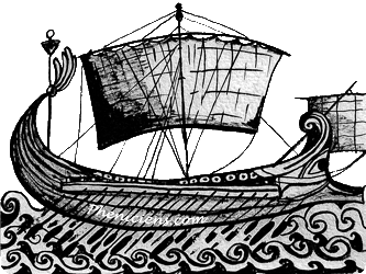
Phoenician boats - Projection Byblos
The Phoenician boats were varied in types, and were equipped with a square sail for navigation. Rowing was reserved for the complementary maneuvering: ports' entrances and exits, tacks, and boarding. Transport ships used for commercial activities, due to the roundness of their shell, were called by the Greeks "gauloï" (round), their carrying capacity was very large and their dimensions accounted for approximately twenty to thirty meters long and six to seven meters wide. The stern was round and ended with a fishtail ornament or spiral. The prow also curvilinear was decorated with a zoomorphic frieze (head of horse or hippocampus). On the bow flank there were two eyes that had a double symbolic value: making the road visible and to intimidate the enemies.
The propulsion of those ships was assured by a mainmast, which supported a sail attached by a yardarm, and was geared as per the wind direction. The navigation depended on a rudder consisting of large stenter asymmetric blades, placed to the left, near the stern. On the bridge was located a shelter for the crew (for twenty men) and the galley.
Phoenician warships were narrower than those devoted to trade. The stern was similar to those of commercial vessels, whereas the prow differed significantly. It formed the most important portion of the ship and it constituted an offensive weapon for combat. At the extremity was the spur or rostrum, which is nothing other than a bronze spike which served to break the flanks of enemy ships. The propulsion of warships was more complicated as it was indispensable, during the battle, to evolve and change course suddenly in order to strike the enemy with the rostrum, while avoiding the blows of the enemy ships. For that reason two masts stood on the bridge, the central one carried the mainsail and the other, located in the bow, wore a small sail to pilot the ship even with cross winds.
Pottery and commerce
The oldest and most basic Phoenician ship was the Penteconter with a length of approximately twenty-five meters, and a crew of fifty oarsmen (evenly distributed on both sides), and naturally one commander. The second was with the pilot and the sailors maneuvering the sails, and whose number did not exceed ten. The most famous ship remains the trireme, undisputed mistress of the Mediterranean between the IV and VII century BC. The vessel could accommodate a crew of about 180 sailors. Other forms of vessels were used: quadrireme and quinquereme were built in Carthaginian shipyards. The crews of these ships were respectively 240 and 300 sailors assigned to 4 and 5 rows of 30 oars on each side, while the sailors maneuver the sails. The maximum speed that could be reached through the simultaneous use of two modes of propulsion, sailing and rowing, and only on small distances was five to six knots(4).

Ancient port of Carthage, © pheniciens.com
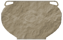
Through the terracotta fragments found in habitats, as well as vases discovered in some necropolises, archaeologists have been able to provide new information on the everyday life of Phoenicians, their funeral rituals and especially on their craftsmanship and their commerce.
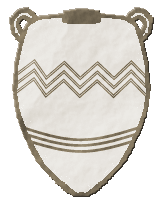
As it has been already mentioned in the article on Phoenician art, Phoenician ceramics were derived from the Syrian-Palestinian pottery of the end of the Bronze Age. It is characterized by its basic decorative aspects in contrast to the accurate and artistic decoration of Greek ceramics. The Phoenicians would paint upon the jars identical shapes which were subsequently decorated in various ways. The dishes were varnished or engobed either partially or in full. There were several distinguishable types: ceramics coated with a red or black varnish, those decorated with black varnish, on red background, or those in white varnish on cream background. For engobes, there existed patterns painted red and black, as well as forms decorated in black and white.
In terms of shapes, they were limited in the presence of a handle or a foot. These forms were intended for several types of use: domestic, commercial and funeral. Some of these utensils could even have multiple functions: for example, a large amphora served in trade (transporting foodstuffs, oil or wine), was reused for domestic necessities (to contain water or cereals …) and thereafter, this same amphora, was employed as an ossuary or a coffin for a child.
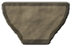
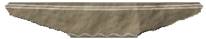
Phoenician ceramic was composed of several models and can be grouped into two forms:
- Open forms: cups, plates, pots, mortars… which were specifically used for the kitchen:
- Closed forms: amphorae, jugs, craters ... were designed to transport grain, olive oil, and wine. Small flacons contain perfumes and ointments. Oil lamps (shell-shaped) with one or two spouts.
Amphora
Amphora
Amphora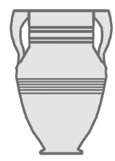
Crater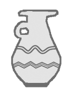
Pitcher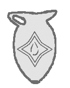
Puisette
In future articles, we will talk about the evolution of this Phoenician ceramic after the foundation of Carthage and the contribution of new forms that earned it the name: of Western Phoenician ceramic.
Installations in the Mediterranean Sea
"Those who inhabited the country of Canaan and which the Greeks, since Homer, we learned to nominate Phoenicians, seem to have benefited from the effects induced by the terrible invasion of the Sea Peoples around 1200 BC and the collapse of the Mycenaean thalassocracy . It was at the dawning of the Iron Age, the Mediterranean was deserted. The Phoenicians took advantage, those who had a powerful navy through the technical progress achieved in the navigation field. They seem to have succeeded very early to read the firmament. After having long been reduced to cabotage, the Phoenician navy was feeling able to confront the large"(5).
This paragraph includes in a few lines, all of the reasons and rules that have led the Phoenicians to leave their cities and travel around the seas. Nonetheless the question to which historians and archaeologists have long remained divided, is on the age of the Phoenician installations on the Mediterranean land. Some of them were defending the Phoenician superiority while others brought back these installations to the same period as those of the Greeks. The new archaeological discoveries have strengthened the first thesis, claiming the anteriority of the Phoenician expansion.
The whole purpose of the Phoenicians was the discovery of new countries and the raw materials that can enrich their trade. Their installations were limited to trading bases where they could get supplies before continuing on with their shipments. The agricultural movement developed as an auxiliary to these trading posts, in order to ensure food supplies. In contrast to the Greeks who settled in the colonies, the Phoenicians were content with these ports of call, constituted as relays(6) in a commercial perspective, to facilitate contact with neighboring populations. The core of the Phoenician establishment was the sanctuary, which they hastened to build as soon their arrival, dedicated to their gods (Astarte, Baal, Melqart ...) searching their protection.
As we noted above, the beginning of the adventure was limited to maritime cabotage and coastal navigation. The first real stop was based in Cyprus (the island of the Copper). The various excavations evoke a Phoenician presence at least from the ninth century. The main center was Kition (in present-day Larnaca), but the Phoenicians had developed several counters, among others, in Paphos, Tamassos and all around the island.
After Cyprus, Phoenician sailors ventured into the archipelago of the Aegean Sea. Homer mentions the commercial counters, some supporting points founded by some merchants. Crete, Euboea and the Dodecanese islands seem to have preserved some evidence amounts of this presence at the beginning of the first millennium(7). Between legend(8) and history, we could say that, during these initial exchanges, Greeks learned to use the Phoenician alphabet, which they subsequently adapted to create their own language.
Progressively and throughout many years the Phoenician facilities developed all around the Mediterranean area. The Misadventures of Wenamun denotes the ship-owners activities form Sidon and Gibal (Byblos) in the port of Tanis, the new Egyptian capital, situated on the Nile Delta, and this before the beginning of the first millennium. Herodotus, in his work "Researches or Histories", evokes a "Tyrian camp" based in Memphis with a sanctuary of Astarte, Phoenician goddess.
More Phoenician trading posts emerged on the North Africa coast, some are subsequently transformed into great and powerful cities:
* Libya and more precisely in Tripoli: Necropolis III-II centuries BC,
* Tunisia: Carthage, Thapsus, Hadrumetum and Kerkuane: Discoveries of cemeteries and tophets,
* Algeria: Cirta Icosium, Rachgoun: traces of graves, coins,
* Morocco: Emsa, Lixus, Mogador ...
Throughout their progress, Phoenicians have also settled on the islands, major strategic places on their navigation routes: Malta (Tas Silg), Sicily (Motya), Sardinia (Cagliari, Tharros, Nora), not to mention the Spanish islands (Cadiz, Ibiza) the countries of metals and wealth (gold and silver). The Phoenician ships also crossed the Pillars of Hercules and went as far as Brittany and Cornwall looking for tin mines.
The exploratory voyages
Besides the commercial expedition, The Phoenicians were interested in discovering new horizons. These exploratory trips could be accomplished with the financial support and participation of some wealthy allies. Of these trips we mention shipments, conducted towards the tenth century BC, in collaboration between King Hiram of Tyre and King Solomon in direction of the country of Ophir, probably in East Africa, from where they reported gold. New archaeological discoveries suggest that the port of departure was perhaps the one of Jeziret Fara'un, southwest of Eilat, on a small island whose installations are reminiscent of Phoenician establishments(9).

Pillars of Hercules - Ceuta
Another voyage, always in the direction of Africa, was funded by the Pharaoh Necho II in the late seventh century BC. According to Herodotus, they would be gone from an Egyptian port on the Red Sea, have circumvented Africa to cross, three years after their departure, the Pillars of Hercules (now Gibraltar). These voyages could not be certified in a scientific manner but instead they bore witness to the reputation acquired by Phoenician explorers. In addition to these two trips, those of Carthage, the trip of Himilcon, which circumvented the northwest European coast to reach the British and oestrymnides Isles, and the famous journey of King Hannon, who ventured into the waters of the Atlantic Ocean, in the fifth century. This last adventure seems to be more truthful through archaeological traces found on the Moroccan coast and especially Mogador. From 2008 to 2010, Phoenicia, the expedition ship headed by Philip Beale, recreates the same conditions of the period in order to make the circumnavigation of Africa, accomplished by the Phoenicians in 600 BC.
| (1) |
Cf. Gras, Rouillard & Teixidor, L'univers phénicien, Editions Hachette, 1995. |
Retour texte |
| (2) |
Cf. F. Briquel Chatonnet & E. Gubel, Les Phéniciens aux origines du Liban, Gallimard, 1998. |
Retour texte |
| (3) |
Cf. P. Bartoloni, "Les Navires et la Navigation", dans Les Phéniciens, sous la direction de S. Moscati, Stock, 1997. |
Retour texte |
| (4) |
Ibid. |
Retour texte |
| (5) |
M.H.Fantar,"les Phéniciens et la Méditerranée" dans Liban l'autre rive, p.117. |
Retour texte |
| (6) |
Cf. M.Gras et autres, op.cit., p.140. |
Retour texte |
| (7) |
Cf. F.B-C. & E.G., op.cit., p.93. |
Retour texte |
| (8) |
La légende de Cadmos parti à la recherche de sa sœur la princesse Europe enlevée par Zeus. |
Retour texte |
| (9) |
Cf. F.B-C. & E.G., op.cit., p.89. |
Retour texte |